AREA 73 - CEDAR CITY VALLEYUpdated:ĀSeptember 9, 2021Changes from prior policy text in red text. |
|
|
MANAGEMENT Water rights in this area were first compiled into a proposed determination of water rights in 1947. This publication was superseded by the completion of four proposed determination books in 1966; a pre-trial order was issued in 1970. There are two state-administered water distribution systems in this area; the Coal Creek Distribution System oversees the distribution of surface water from Coal Creek, while the Cedar City Valley Distribution System monitors the ground-water pumpers. Both systems are under the jurisdiction of the Cedar City Valley Commissioner. The Cedar Breaks National Monument Water Rights Settlement Agreement was signed in April 2000 and quantifies the appurtenant water rights. Click here to see statistics for this area. SOURCES Surface and Ground Water - All waters of the basin are considered to be fully appropriated. New diversions and uses must be accomplished by change applications based on valid existing water rights. Fixed-time projects must be accomplished by temporary change applications on valid existing water rights, which require annual renewal. The basin is divided into two subareas. The boundary is generally delineated by the route of State Highway 56 through the valley. No change applications between subareas are allowed. Change applications proposing a change from surface to underground sources or vice versa will be critically reviewed to assure hydrologic connection, that there are no enlargements of the underlying right(s), and that there will be no impairments of other rights. GROUNDWATER MANAGEMENT PLANS
GENERAL Applications are advertised in the Spectrum/Daily News. The general irrigation diversion duty for this area, which the State Engineer uses for evaluation purposes, is 4.0 acre-feet per acre per year. The consumptive use requirement is determined from the publication Consumptive Use of Irrigated Crops in Utah, Research Report 145, Utah State University, 1994, unless the applicant submits other data for consideration. This area is administered by the Southwest Regional Office in Cedar City. Other Requirements The Water Right applicant is strongly cautioned that other permits may be required before any physical development of a project can begin and it is the responsibility of the applicant to determine the applicability of and acquisition of such permits. In order to avoid delays and ensure that Water Right approvals conform to applicable local ordinances, applicants should contact local governmental entities in advance to determine what ordinances are in place that affect the proposed project and to make sure that Water Right filings conform to those ordinances. The approval of a Water Right application does not imply any approval of a project by any other governmental entity. Approval of the project proposed in the Water Right application should be obtained from local governmental entities as necessary to implement a project. REFERENCES Technical Publication No. 13; Ground-Water Resources of Selected Basins in Southwestern Utah; Utah State Engineer; 1966. Technical Publication No. 15; Water from Bedrock in the Colorado Plateau of Utah; Utah State Engineer; 1966. Technical Publication No. 60; Ground-Water Resources of the Parowan-Cedar City Drainage Basin, Iron County, Utah; Utah Department of Natural Resources; 1978. Basic Data Report No. 6; Groundwater Data, Beaver, Escalante, Cedar City, and Parowan Valleys, Parts of Washington, Iron, Beaver, and Millard Counties, Utah; Utah State Engineer; 1963. (Out of print) Basic Data Report No. 28; Selected Hydrologic Data, Parowan Valley and Cedar City Valley Drainage Basins, Iron County, Utah; Utah Department of Natural Resources; 1977. Information Bulletin No.15; Groundwater Conditions and Related Water-Administration Problems, Cedar City Valley, Iron County, Utah; Utah State Engineer; 1966. (Out of print) Water-Resources Investigative Report 95-4173, Simulated Effects of Proposed Ground-Water Pumping in 17 Basins in East-Central and Southern Nevada; U.S. Geological Survey; 1995 (viewing this document requires the DjVu browser plugin available from LizardTech) USGS Scientific Investigations Report 2014-5213, Steady-State Numerical Groundwater Flow Model of the Great Basin Carbonate and Alluvial Aquifer System; 2014. USGS Scientific Investigations Report 2017-5072, Groundwater Model of the Great Basin Carbonate and Alluvial Aquifer System Version 3.0: Incorporating Revisions in Southwestern Utah and East Central Nevada; 2017. MODELING Regional Ground-Water Flow, Carbonate-Rock Province, Nevada, Utah, and Adjacent States; USGS Open-File Reports 93-170 and 93-420; 1993. PREVIOUS PAGE UPDATES |
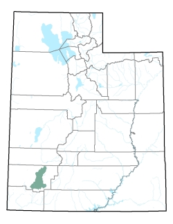
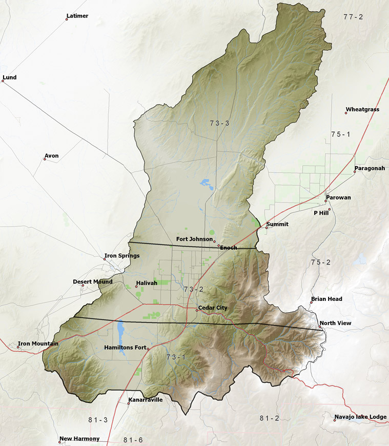
Policy area in green,
click on the map for more detail DESCRIPTION Reaching from T31S to T37S in Iron County, this drainage basin, of about 580 square miles, includes the surface source of Coal Creek in the southeast and several intermittent streams that flow from the Black Mountains in the north. It is bounded on the west by the 7,200 foot Harmony Mountains and the Swett Hills, on the south and east by the 11,307 foot Markagunt Plateau and Cedar Mountain, and on the north by the 8,700 foot Black Mountains. Low saddles on the south, northeast, and northwest lead to the adjacent Ash Creek, Parowan, and Escalante Valleys, respectively. The lowest point is Mud Springs Gap at 5,350 feet, giving the basin a total relief of about 5,250 feet. |
|
|
|