AREA 68 - SEVIER DESERTUpdated:ĀApril 13, 2011 |
|
|
MANAGEMENT The Sevier River Decree of 1937 (issued after compilation of a proposed determination of water rights by the State Engineer in the 1920s) apportioned the river and it's tributaries. Some diligence claims have been filed on isolated springs that have not been included by the decree. The State Engineer administers a distribution system to oversee allocations of many of the awards. Click here to see statistics for this area. SOURCES Surface and Ground Water - Under a Governor's Proclamation dated December 19, 1946, the
surface waters of the Sevier River Basin were closed to all new
appropriations. Since that time, all new development of surface
water for consumptive purposes has been based on the acquisition
and changing of existing valid surface water rights. As of March
19, 1997, the Sevier River Basin was closed to all new
appropriations of ground water except as set forth in the
Sevier River Basin
Ground-water Management plan. The plan allows for domestic filings
not to exceed 1.0 acre-foot in R8W and R9W and for filings reviewed
on an individual basis in R10W to R13W. Proposed diversions above
the valley alluvium and/or where they may intercept sources
tributary to the Sevier River will not be granted. Change
applications in the Lynndyl, Leamington, Oak City, Oasis and
Delta vicinity are limited to amending rights already in the
area. No acquired rights outside of the area can be moved into
it (see map). GROUNDWATER MANAGEMENT PLAN Effective November 5, 1997 the area is subject to the conditions of the Sevier River Basin Groundwater Policy. The policy was created to address issues raised after study of the basin hydrology and management alternatives. The major issue discussed was the close hydrologic connection between the surface water and ground water.GENERAL Applications in this area are advertised in the Millard County Progress newspaper. The general figure for irrigation diversion duty in this area is 4 acre-feet per acre. The consumptive use requirement is determined from the publication Consumptive Use of Irrigated Crops in Utah, Research Report 145, Utah State University, 1994, unless the applicant submits other data for consideration. This area is administered by the Sevier River/Southern Regional Office in Richfield. Other Requirements The Water Right applicant is strongly cautioned that other permits may be required before any physical development of a project can begin and it is the responsibility of the applicant to determine the applicability of and acquisition of such permits. In order to avoid delays and ensure that Water Right approvals conform to applicable local ordinances, applicants should contact local governmental entities in advance to determine what ordinances are in place that affect the proposed project and to make sure that Water Right filings conform to those ordinances. The approval of a Water Right application does not imply any approval of a project by any other governmental entity. Approval of the project proposed in the Water Right application should be obtained from local governmental entities as necessary to implement a project. REFERENCES Water-Resources Investigative Report 95-4173, Simulated Effects of Proposed Ground-Water Pumping in 17 Basins in East-Central and Southern Nevada; U.S. Geological Survey; 1995 (viewing this document requires the DjVu browser plugin available from LizardTech) USGS Scientific Investigations Report 2014-5213, Steady-State Numerical Groundwater Flow Model of the Great Basin Carbonate and Alluvial Aquifer System; 2014. USGS Scientific Investigations Report 2017-5072, Groundwater Model of the Great Basin Carbonate and Alluvial Aquifer System Version 3.0: Incorporating Revisions in Southwestern Utah and East Central Nevada; 2017. MODELING None available. PREVIOUS PAGE UPDATES None available. |
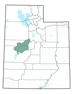
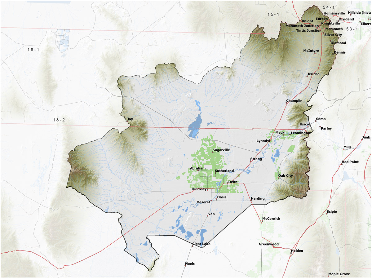
Policy area in green,
click on the map for more detail DESCRIPTION Extending from southern boundary of Tooele County (T10S) through Juab County to the middle of Millard County (T21S), this drainage are covers the water of the Sevier River from the Millard County border to Sevier Lake and storage facilities in DMAD, Gunnision Bend, Fool Creek No. 1, and Fool Creek No. 2 Reservoirs. Several creeks and washes run from the mountains around this area toward the Sevier River Plain but empty prior to reaching it and can be intermittent in nature. |
|
|
|