AREA 61 - UPPER SEVIER RIVERUpdated: February 19, 2025 |
|
|
MANAGEMENT The Sevier River Decree of 1937 (issued after compilation of a proposed determination of water rights by the State Engineer in the 1920s) apportioned most surface waters. Some diligence claims have been filed on isolated springs that may have been overlooked by the decree. The State Engineer administers a distribution system to oversee allocation of many of the awards. Click here to see statistics for this area. SOURCES Surface and Ground Water - The Sevier River Decree of 1937 (issued after compilation of a proposed determination of water rights by the State Engineer in the 1920s) apportioned most surface waters. Some diligence claims have been filed on isolated springs that may have been overlooked by the decree. The State Engineer administers a distribution system to oversee allocation of many of the awards. Click here to see statistics for this area. GROUNDWATER MANAGEMENT PLAN Effective November 5, 1997 the area is subject to the conditions of the Sevier River Basin Groundwater Policy. The policy was created to address issues raised after study of the basin hydrology and management alternatives. The major issue discussed was the close hydrologic connection between the surface water and ground water.GENERAL Applications in this area are advertised in the Garfield County News, Richfield Reaper, or Southern Utah News newspapers. The general figure for irrigation diversion duty in this area is 3 acre-feet per acre. However, some high-elevation, short-season meadows may require only 2 acre-feet per acre. The consumptive use requirement is determined from the publication Consumptive Use of Irrigated Crops in Utah, Research Report 145, Utah State University, 1994, unless the applicant submits other data for consideration. This area is administered by the Sevier River/Southern Regional Office in Richfield. Other requirements The Water Right applicant is strongly cautioned that other permits may be required before any physical development of a project can begin and it is the responsibility of the applicant to determine the applicability of and acquisition of such permits. In order to avoid delays and ensure that Water Right approvals conform to applicable local ordinances, applicants should contact local governmental entities in advance to determine what ordinances are in place that affect the proposed project and to make sure that Water Right filings conform to those ordinances. The approval of a Water Right application does not imply any approval of a project by any other governmental entity. Approval of the project proposed in the Water Right application should be obtained from local governmental entities as necessary to implement a project. Area of Concern - Cedar Breaks National Monument Cedar Breaks NM has retained water rights for all water resources in the monument as described in the Water Rights Settlement Agreement (Utah Division of Water Rights 2000). The monument is allowed to deplete up to 2 acre-feet of water per year from the Sevier River Basin and 3 acre-feet per year from the Cedar City Valley drainage. Click header link for more information. REFERENCES UGS Open File Report 733, Hydrogeologic Study of the Bryce Canyon City Area, including Johns and Emery Valleys, Garfield County, Utah; 2021. MODELING None available. PREVIOUS PAGE UPDATES |
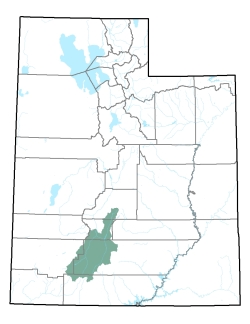
Policy area in green,
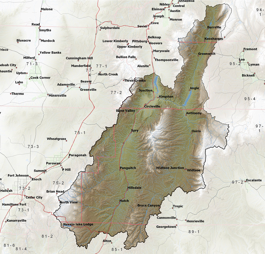
click on the map for more detail DESCRIPTION Extending from the northern portion of Kane County (T39S) through Garfield and Piute Counties to the southern portion of Sevier County (T24S), this drainage area includes the headwaters of the Sevier River, the East Fork of the Sevier River, Otter Creek, Panguitch Creek, Mammoth Creek, and Asay Creek and storage facilities at Koosharem, Otter Creek, Panguitch Lake, Piute, and Tropic Reservoirs. |
|
|
|