AREA 59 - WESTERN SALT LAKE VALLEYUpdated:ĀApril 13, 2011 |
|
|
MANAGEMENT Five Proposed Determination of Water Rights books have been published: the Northwest subdivision in 1975, the Central and West subdivisions in 1977, and the Southwest subdivision and a supplemental book in 1979. No pre-trial orders have been issued. There are several other decrees in this area. There are two state-administered distribution system in this area. The Utah Lake-Jordan River Distribution System is administered by the Utah Lake-Jordan Commissioner. The Lower Jordan River Distribution System is administered by the Lower Jordan Commissioner. This area is subject to the conditions of the Utah Lake Water Distribution Plan. Click here to see statistics for this area. SOURCES Surface Water - All surface water are fully appropriated. Development of new,
or different, consumptive use projects involving surface water must be accomplished
by change applications based on owned or acquired existing rights. Non-consumptive
use applications, such as hydroelectric power generation, will be considered
on their individual merits. Changes from surface to underground sources are
not allowed in the valley fill. Fixed-time and temporary projects involving
surface waters must be handled by temporary change applications. Changes
based on shares of stock in irrigation companies and exchanges based on contracts
with the Central Utah Water Conservancy District have been approved to authorize
development in this closed area. Applicants are placed on notice that development
should be pursued as soon as possible, and requests for extensions of time
in which to file proof will be critically reviewed after an initial five year
period. GROUNDWATER MANAGEMENT PLAN This area is subject to the conditions of the Salt Lake Valley Ground-water Management Plan, the objectives of which are to promote wise use of the groundwater resource, to protect existing water rights and to address water quality issues and over-appropriation of ground water in the valley.GENERAL Applications are advertised in the Deseret News. The general irrigation diversion duty, which the State Engineer uses for evaluation purposes, is 5.0 acre-feet per acre per year. The consumptive use requirement is determined from the publication Consumptive Use of Irrigated Crops in Utah, Research Report 145, Utah State University, 1994, unless the applicant submits other data for consideration. This area is administered by the Utah Lake-Jordan River Regional Office in Salt Lake City. Other requirements The Water Right applicant is strongly cautioned that other permits may be required before any physical development of a project can begin and it is the responsibility of the applicant to determine the applicability of and acquisition of such permits. In order to avoid delays and ensure that Water Right approvals conform to applicable local ordinances, applicants should contact local governmental entities in advance to determine what ordinances are in place that affect the proposed project and to make sure that Water Right filings conform to those ordinances. The approval of a Water Right application does not imply any approval of a project by any other governmental entity. Approval of the project proposed in the Water Right application should be obtained from local governmental entities as necessary to implement a project. REFERENCES Technical Publication No. 31, Water Resources of Salt Lake County, Utah; Utah Department of Natural Resources; 1971. Technical Publication No. 34, Summary of Water Resources of Salt Lake County, Utah; Utah Department of Natural Resources; 1971. Technical Publication No. 82, Seepage Study of Six Canals in Salt Lake County, Utah, 1982-83; Utah Department of Natural Resources; 1985. Technical Publication No. 87, Ground-water Conditions in Salt Lake County, Utah, 1969-83, and Predicted Effects of Increased Withdrawals from Wells; Utah Department of Natural Resources; 1987. Technical Publication No. 89, Chemical Quality of Ground-water Flow in Salt Lake Valley, Utah, 1969-85; Utah Department of Natural Resources; 1987. Technical Publication No. 110A, Chemical Composition of Ground-water, Hydrologic Properties of Basin-fill Material, and Ground-water Movement in Salt Lake Valley, Utah; Utah Department of Natural Resources; 1995. Technical Publication No. 110B, Numerical Simulation of Ground-water Flow in Salt Lake Valley, Utah; Utah Department of Natural Resources; 1995. Technical Publication No. 110C, Particle Tracking Analysis of Flow Paths and Travel Times within the Capture Areas of Well Fields in Salt Lake Valley, Utah; Utah Department of Natural Resources; 1995. Technical Publication No. 110D, Numerical Simulation of Solute Transport in Salt Lake Valley, Utah; Utah Department of Natural Resources; 1995. Water Circular No. 1, Ground Water in the Jordan Valley, Salt Lake County, Utah; Utah Department of Natural Resources; 1965. Basic-Data Report No. 4, Selected Hydrologic Data, Jordan Valley, Salt Lake County, Utah; Utah State Engineer; 1963. Basic-Data Report No. 11, Hydrologic and Climatologic Data Collected through 1964, Salt Lake County, Utah; Utah Department of Natural Resources; 1966. Basic-Data Report No. 12, Hydrologic and Climatologic Data, 1965, Salt Lake County, Utah; Utah Department of Natural Resources; 1966. Basic-Data Report No. 13, Hydrologic and Climatologic Data, 1966, Salt Lake County, Utah; Utah Department of Natural Resources; 1967. Basic-Data Report No. 15, Hydrologic and Climatologic Data, 1967, Salt Lake County, Utah; Utah Department of Natural Resources; 1968. Basic-Data Report No. 17, Hydrologic and Climatologic Data, 1968, Salt Lake County, Utah; Utah Department of Natural Resources; 1969. Basic-Data Report No. 36, Hydrologic and Climatologic Data, Salt Lake County, Utah, Water Year 1980, 1981; Utah Department of Natural Resources; 1981. Basic-Data Report No. 40, Surface Water and Climatologic Data, Salt Lake County, Utah, Water Year 1981, with Selected Data for Water Years 1980, 1982, and 1983; Utah Department of Natural Resources; 1983. Basic-Data Report No. 44, Selected Hydrologic for Salt Lake Valley, Utah, October 1968 to October 1985; Utah Department of Natural Resources; 1986. Basic-Data Report No. 49, Selected Hydrologic Data for Salt Lake Valley, Utah, 1990-92, with Emphasis on Aquifer and Confining Layers; Utah Department of Natural Resources; 1992. Information Bulletin No. 13, Water Requirements of Lower Jordan River, Utah; Utah Department of Natural Resources; 1964. MODELING Regional Ground-Water Flow, Carbonate-Rock Province, Nevada, Utah, and Adjacent States; USGS Open-File Reports 93-170 and 93-420; 1993. Salt Lake Valley Ground-water Flow Model, 1987. Salt Lake Valley Ground-water Flow Model, 1995. PREVIOUS PAGE UPDATES |
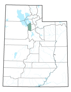
Policy area in green,
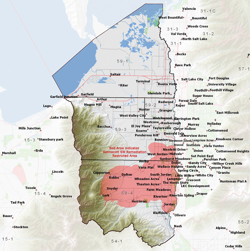
click on the map for more detail DESCRIPTION Covering the eastern half of Salt Lake County from T2N to T4S, this area includes the flows of Rose Canyon Creek, Butterfield Canyon Creek, Bingham Canyon Creek, and a number of intermittent streams draining from the Oquirrh Mountains to the Jordan River and eventually the Great Salt Lake. The area is bordered on the north by Great Salt Lake, on the west by Tooele Valley, on the south by the Utah Lake drainage, and on the east by the eastern part of the Jordan River drainage. The highest point in the area is the 9,370 foot Butterfield Peaks, while the lowest is the surface of the Great Salt Lake at about 4,200 feet, giving a total relief of about 5,170 feet.Click here to use the Water Rights GIS Map Server to view this area. |
|
|
|