AREA 53 - GOSHEN and NORTHERN JUAB VALLEYSUpdated:ĀApril 11, 2011 |
|
|
MANAGEMENT A Proposed Determination of Water Rights book was published for the Goshen Valley subdivision in 1985. No pre-trial orders or interlocutory decrees have been issued. There are several other decrees in this area. There is no state-administered distribution system in this area. This area is subject to the conditions of the Utah Lake Water Distribution Plan, and two groundwater management plans: the Northern Juab Valley Ground Water Policy (1995), and the Utah/Goshen Valley Ground-water Management Plan. Click here to see statistics for this area. SOURCES Surface and Ground Water - All supplies of water are fully appropriated. Non-consumptive use applications, such as hydroelectric power generation, will be considered on their individual merits. Changes from surface to underground sources, and vice versa, are considered on their individual merits, with emphasis on their potential to interfere with existing rights and to ensure that there is no enlargement of the underlying rights. Fixed-time and temporary projects, especially those involving surface waters, must be handled by temporary change applications. Applicants are placed on notice that dry years may bring about a reduction of artesian pressure, therefore, well construction should accommodate the installation of submersible pumps. Applicants are placed on notice that development should be pursued as soon as possible, and requests for extensions of time in which to file proof will be critically reviewed after an initial five year period. GROUNDWATER MANAGEMENT PLANS Developments in Utah Valley are having an impact on the land use practices in Juab Valley. Ground-water development and changes in water use practices appear to have an effect on the Utah Lake System, which is fully appropriated. Changing land use practices and the hydrologic connection between Northern Juab Valley and Utah Lake have prompted the State Engineer to re-evaluate his policy for Northern Juab Valley. The plan is effective as of November 15, 1995. The objectives of this plan are to promote the efficient use of the waters of the Utah/Goshen Valley ground-water system within the safe yield of that system and to jointly manage the surface and ground water. Due to urbanization in the area, there are significant changes in water use practices. As water use practices change, the determination of safe yield may need to be modified accordingly. GENERAL Applications are advertised in the Nephi Times-News and the Payson Chronicle. The general irrigation diversion duty for this area, which the State Engineer uses for evaluation purposes, is 4.0 acre-feet per acre per year. The consumptive use requirement is determined from the publication Consumptive Use of Irrigated Crops in Utah, Research Report 145, Utah State University, 1994, unless the applicant submits other data for consideration. This area is administered by the Utah Lake-Jordan River Regional Office in Salt Lake City. Other requirements The Water Right applicant is strongly cautioned that other permits may be required before any physical development of a project can begin and it is the responsibility of the applicant to determine the applicability of and acquisition of such permits. In order to avoid delays and ensure that Water Right approvals conform to applicable local ordinances, applicants should contact local governmental entities in advance to determine what ordinances are in place that affect the proposed project and to make sure that Water Right filings conform to those ordinances. The approval of a Water Right application does not imply any approval of a project by any other governmental entity. Approval of the project proposed in the Water Right application should be obtained from local governmental entities as necessary to implement a project. REFERENCES Technical Publication No. 17, Ground-water Resources of Northern Juab Valley, Utah; Utah Department of Natural Resources; 1967. Technical Publication No. 28, Ground-water Conditions in Southern Utah Valley and Goshen Valley, Utah; Utah Department of Natural Resources; 1970. Technical Publication No. 46, Water-Quality Reconnaissance of Surface Inflow to Utah Lake, Utah; Utah Department of Natural Resources; 1974. Technical Publication No. 111, Hydrology and simulation of ground-water flow in southern Utah and Goshen Valleys, Utah; Utah Department of Natural Resources; 1995. Technical Publication No. 114, Hydrology and simulation of ground-water flow in Juab Valley, Utah; Utah Department of Natural Resources; 1996. Basic-Data Report No. 16, Selected Hydrologic Data, Southern Utah and Goshen Valleys, Utah; Utah Department of Natural Resources; 1969. Basic-Data Report No. 50, Selected Hydrologic Data for Southern Utah and Goshen Valleys, Utah, 1890-1992; Utah Department of Natural Resources; 1992. Information Bulletin No. 18, The Effect of Pumping Large Discharge Wells on the Ground-Water Reservoir in Southern Utah Valley, Utah; Utah State Engineer; 1967. Water-Resources Investigative Report 95-4173, Simulated Effects of Proposed Ground-Water Pumping in 17 Basins in East-Central and Southern Nevada; U.S. Geological Survey; 1995 (viewing this document requires the DjVu browser plugin available from LizardTech) MODELING Regional Ground-Water Flow, Carbonate-Rock Province, Nevada, Utah, and Adjacent States; USGS Open-File Reports 93-170 and 93-420; 1993. Southern Utah and Goshen Valleys Ground-water Flow Model, 1995. Juab Valley Ground-water Flow Model, 1996. PREVIOUS PAGE UPDATES |
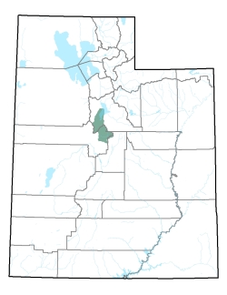
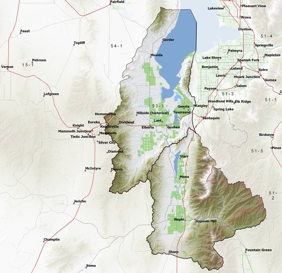
Policy area in green,
click on the map for more detail DESCRIPTION Extending from T6S to T14S in southern Utah County and northeast Juab County, this area includes the Salt Creek and Currant Creek drainages with their primary tributaries of West Creek and Kimball Creek, respectively. All of waters of the area eventually reach Utah Lake. The area is bordered on the north by Utah Lake, on the west and south by Cedar Valley and the Sevier River drainage, and on the east by the Sevier and Spanish Fork River basins. The highest point in the area is 11,877 foot Mt. Nebo, while the lowest is the surface of Utah Lake at about 4,490 feet, giving a total relief of about 7,400 feet. |
|
|
|