AREA 51 - UTAH AND INDIANOLA VALLEYSUpdated:ĀNovember 3, 2022Recent changes and additions in red text |
|
|
MANAGEMENT Four Proposed Determination of Water Rights books have been published: Books 1 & 2, covering Spanish Fork Canyon, were published in 1976; Books 3 & 4, covering the Palmyra-Lake Shore and Hobble Creek-Springville areas, were issued in 1986. An addendum to Book 4 was published in 1992. No pre-trial orders or interlocutory decrees have been issued. There are several other decrees in this area. There is one state-administered distribution system in this area, the Spanish Fork River Distribution System. It is administered by the Spanish Fork River Commissioner. Click here to see statistics for this area. SOURCES Surface and Ground Water - All supplies of water are fully appropriated. Non-consumptive use applications, such as hydroelectric power generation, will be considered on their individual merits. Changes from surface to underground sources, and vice versa, are considered on their individual merits, with emphasis on their potential to interfere with existing rights and to ensure that there is no enlargement of the underlying rights. Fixed-time and temporary projects, especially those involving surface waters, must be handled by temporary change applications. Applicants are placed on notice that dry years may bring about a reduction of artesian pressure, therefore, well construction should accommodate the installation of submersible pumps. Applicants are placed on notice that development should be pursued as soon as possible, and requests for extensions of time in which to file proof will be critically reviewed after an initial five year period. Governor's Proclamation 2022-01 - On November 3, 2022, Governor Spencer Cox issued a proclamationĀsuspending new appropriations of surplus and unappropriated waters in the Great Salt Lake Basin pursuant to Utah Code 73-6-1. To read the press release from the Governor's office, click here. To read the proclamation, click here. A report on the proclamation to suspend appropriations in Great Salt Lake Basin was published on November 22, 2023 and can be read here. To view a map of areas subject to the proclamation, click here.The following are excepted from the effect of this proclamation:
GROUNDWATER MANAGEMENT PLANS This area is subect to the conditions of:
GENERAL Applications in Utah County are advertised in the Payson Chronicle, the Spanish Fork Press, the Springville Herald, and, on occasion, the Provo Daily Herald. Applications in Sanpete County are advertised in the Mt. Pleasant Pyramid. The general irrigation diversion duty for this area, which the State Engineer uses for evaluation purposes, is 4.0 acre-feet per acre per year. The consumptive use requirement is determined from the publication Consumptive Use of Irrigated Crops in Utah, Research Report 145, Utah State University, 1994, unless the applicant submits other data for consideration. This area is administered by the Utah Lake-Jordan River Regional Office in Salt Lake City. Other requirements The Water Right applicant is strongly cautioned that other permits may be required before any physical development of a project can begin and it is the responsibility of the applicant to determine the applicability of and acquisition of such permits. In order to avoid delays and ensure that Water Right approvals conform to applicable local ordinances, applicants should contact local governmental entities in advance to determine what ordinances are in place that affect the proposed project and to make sure that Water Right filings conform to those ordinances. The approval of a Water Right application does not imply any approval of a project by any other governmental entity. Approval of the project proposed in the Water Right application should be obtained from local governmental entities as necessary to implement a project. REFERENCES Technical Publication No. 28, Ground-water Conditions in Southern Utah Valley and Goshen Valley, Utah; Utah Department of Natural Resources; 1970. Technical Publication No. 46, Water-Quality Reconnaissance of Surface Inflow to Utah Lake, Utah; Utah Department of Natural Resources; 1974. Technical Publication No. 111, Hydrology and simulation of ground-water flow in southern Utah and Goshen Valleys, Utah; Utah Department of Natural Resources; 1995. Basic-Data Report No. 16, Selected Hydrologic Data, Southern Utah and Goshen Valleys, Utah; Utah Department of Natural Resources; 1969. Basic-Data Report No. 50, Selected Hydrologic Data for Southern Utah and Goshen Valleys, Utah, 1890-1992; Utah Department of Natural Resources; 1992. Information Bulletin No. 18, The Effect of Pumping Large Discharge Wells on the Ground-Water Reservoir in Southern Utah Valley, Utah; Utah State Engineer; 1967. USGS Scientific Investigations Report 2014-5213, Steady-State Numerical Groundwater Flow Model of the Great Basin Carbonate and Alluvial Aquifer System; 2014. USGS Scientific Investigations Report 2017-5072, Groundwater Model of the Great Basin Carbonate and Alluvial Aquifer System Version 3.0: Incorporating Revisions in Southwestern Utah and East Central Nevada; 2017. MODELING Regional Ground-Water Flow, Carbonate-Rock Province, Nevada, Utah, and Adjacent States; USGS Open-File Reports 93-170 and 93-420; 1993. Southern Utah and Goshen Valleys Ground-water Flow Model, 1995. PREVIOUS PAGE UPDATES |
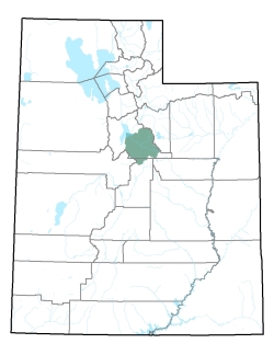
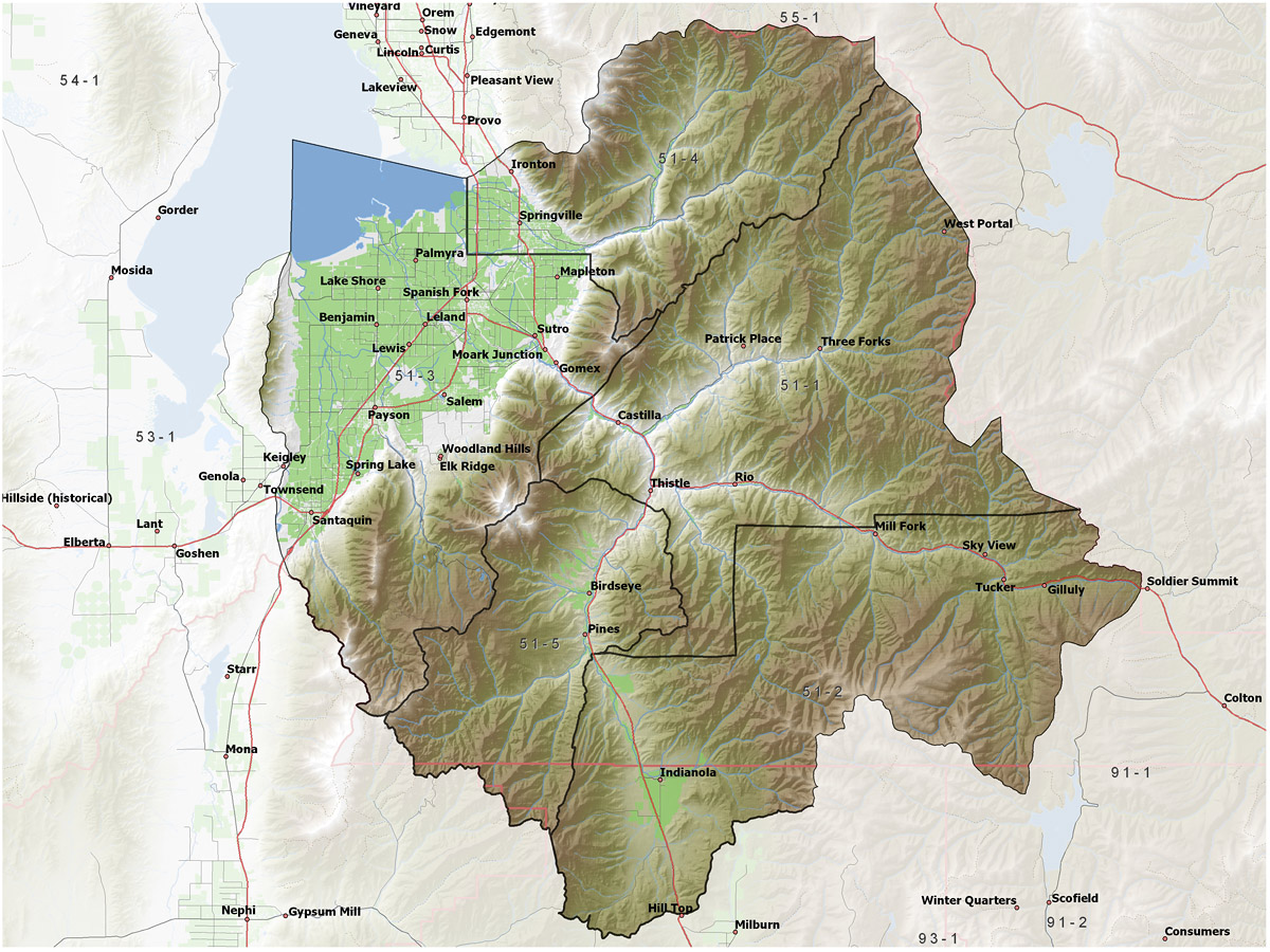
Policy area in green,
click on the map for more detail DESCRIPTION Extending from T6S to T12S in Utah County and the northernmost part of Sanpete County, this area includes the Spanish Fork River drainage with its primary tributaries of Soldier Creek, Thistle Creek, and Diamond Fork. Also, included are the drainages of Hobble, Maple, Peteetneet, and Summit Creeks. All of these streams flow into Utah Lake. It is bordered on the north and west by Utah Lake and Goshen Valley and on the south and west by the Duchesne and Sevier River basins. The highest point in the area is 10,192 foot Spanish Fork Peak, while the lowest is the surface of Utah Lake at about 4,490 feet, giving a total relief of about 5,700 feet. |
|
|
|