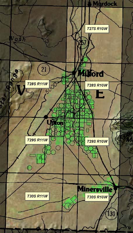
Click on the yellow highlighted townships on the map below to jump to PDF versions
of the Hydrographic Survey Sheets for Area 71.
These PDFs show digitized coverages based on June 2002 aerial photography which
were georectified and digitized by Sharon Wille. These
polygons have been placed atop standard USGS DOQ imagery dating from 1997-1998.
Viewing the .PDFs requires that the Adobe
Acrobat Reader is installed on your computer. The
hydrographic
survey .PDF files average one megabyte each, please allow time for them to fully
download.